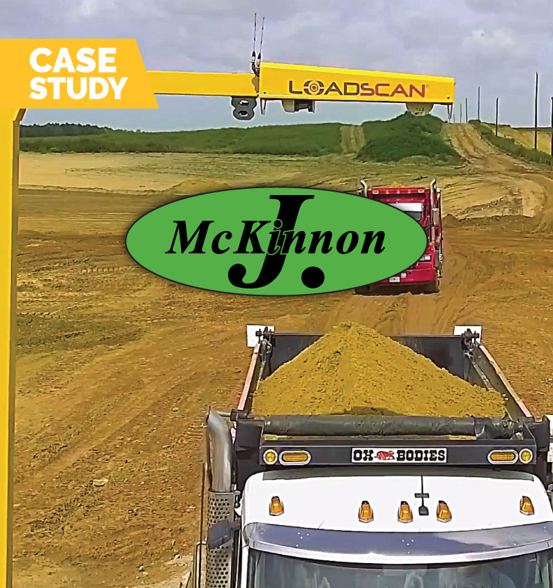
 J McKinnon - Automated measurement across multiple sites
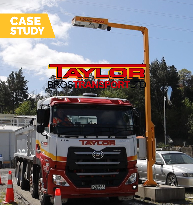 Taylor Bros Transport, Tauranga NZ
Project Details
| CATEGORY: | Civil Construction |
| LOCATION: | NSW, Australia |
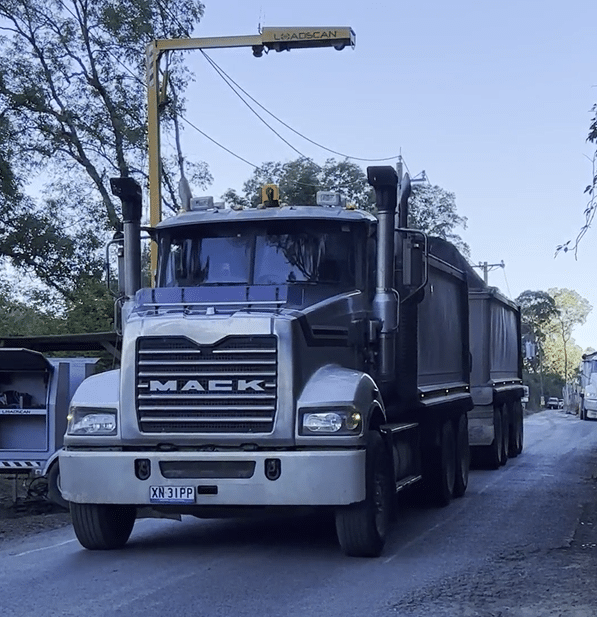
| PRODUCT: | LVS-3TMM |
| WEBSITE: | hawkesbury.nsw.gov.au |
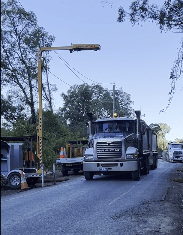
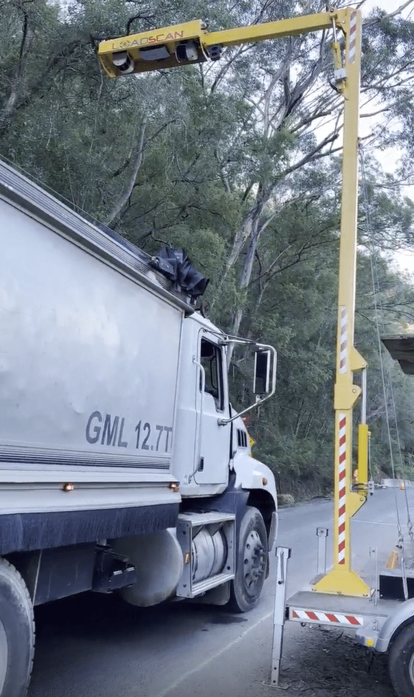
Loadscan LVS assists disaster recovery
When significant floods hit New South Wales in mid-2022, parts of the region were devastated, washing away homes, displacing families and ruining livelihoods.
It was the third major flood some parts of the region had suffered in 2022, and the Hawkesbury River – one of the main tributaries in the Sydney area – peaked at 14m, a level not seen for decades. Meanwhile, the Warragamba Dam, which serves as the primary reservoir for the water supply for Sydney, overflowed, flooding areas downstream with more than 500 gigalitres of water – around 20% of the massive lake’s total capacity.
Once the water had receded, the huge level of damage was apparent, causing major issues for councils, utilities companies and service providers as they swung into action to get the region back on its feet.
One of the larger projects fell to the Hawkesbury City Council, which was tasked with clearing a major landslip on the banks of the Hawkesbury River near the settlement of Wiseman’s Ferry, around 75km northwest of Sydney. There, almost 30,000m2 of earth had come down, blocking a road and causing major issues for those in the area.
Solving problems
Sadat Rahman, the Project Manager Infrastructure Recovery for the council, confirmed the size and nature of the job posed some problems for the council.
“The council has never done a job with this level of excavation – it was a huge landslip area,” he says.
After engaging a surveyor and contractor to undertake the job, Sadat’s next challenge was to ensure the accuracy of the data coming out of the site, and to match that with payments that were being made to the relevant parties.
“One of the challenges was how and what we’d use to measure this, how we make an informed decision for the claims,” Sadat explains.
After initial discussions, the Loadscan LVS-3TMM was suggested as the solution to the unique challenges posed by the difficult job.
Accurate to within +/-1%, the Loadscan system was selected as the best solution for the role and was quickly installed on-site in order to capture the information that was necessary to meet the level of detail required under the contract Sadat was managing.
“On a normal scale job, we wouldn’t need a Loadscan, but when we’re talking about 29,000m2 of loadout material, that’s huge, and that’s why we thought we needed to check what we were taking out…and to double check with the surveyor information.”
Keeping track of vehicle movements
Trucks were fitted with Radio Frequency Identification (RFID) tags to ensure loads were tracked accurately, making for more efficient truck movements into and out of the challenging site. Once each truck had completed a reference scan and had their details loaded into the system, every subsequent load by that truck was then automatically picked up by the RFID receiver, with all the relevant details uploaded in real time to the Loadscan LVS.
In addition to using the Loadscan to measure what was coming out of the site, the surveyor also used a drone on a monthly basis to estimate the amount of material in the body of the landslip.
“Before they started any work, they do a scan [with the drone], and at the end of the month they do another scan; that difference gives the volume of material that we removed.
“That information is then double checked by the Loadscan.”
As part of that process, Sadat discovered that drone-generated figures were considerably different to those provided by the more accurate Loadscan LVS due to the compaction of the material on the site that was being measured prior to being loaded out.
Ensuring accuracy of data
The information delivered by the LVS also assisted Sadat with reconciling financial requirements with the contract company, especially when the scans made it easy to differentiate the type of material being hauled from the site.
As part of the contract, there was a different cartage rate for spoil and rock, which initially proved difficult to manage until raw data was made available to Sadat, where the 3D scans confirmed exactly what was being hauled from the site.
“In our contract, there was a rate for spoil and a separate rate for rock,” he explains. “The drone survey does not differentiate what is rock and what is spoil.
“When it’s spoil, you cannot say it’s rock. Rock is a higher price and, once I got the raw data, I declined lots of payments.
“The scanner helped me a lot. It helped to solve that problem.”
The Loadscan difference
As well as solving a problem for the HCC on this project, Sadat says the process of implementing Loadscan’s LVS on the site was made far easier with the assistance of Loadscan’s staff.
“Whatever we requested, you were there to help us, to give us training, which helped us a lot to get familiar with the system.
“You were there to help us.”
Discover more Case Studies here
